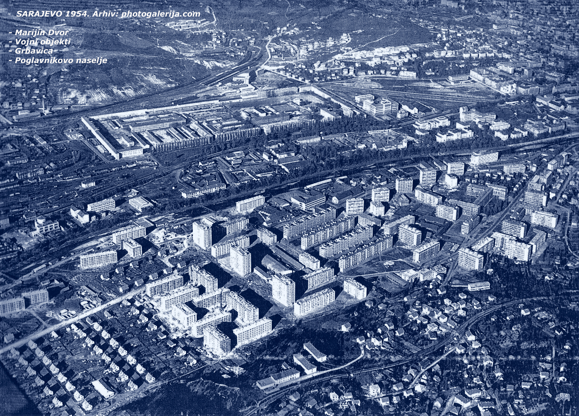
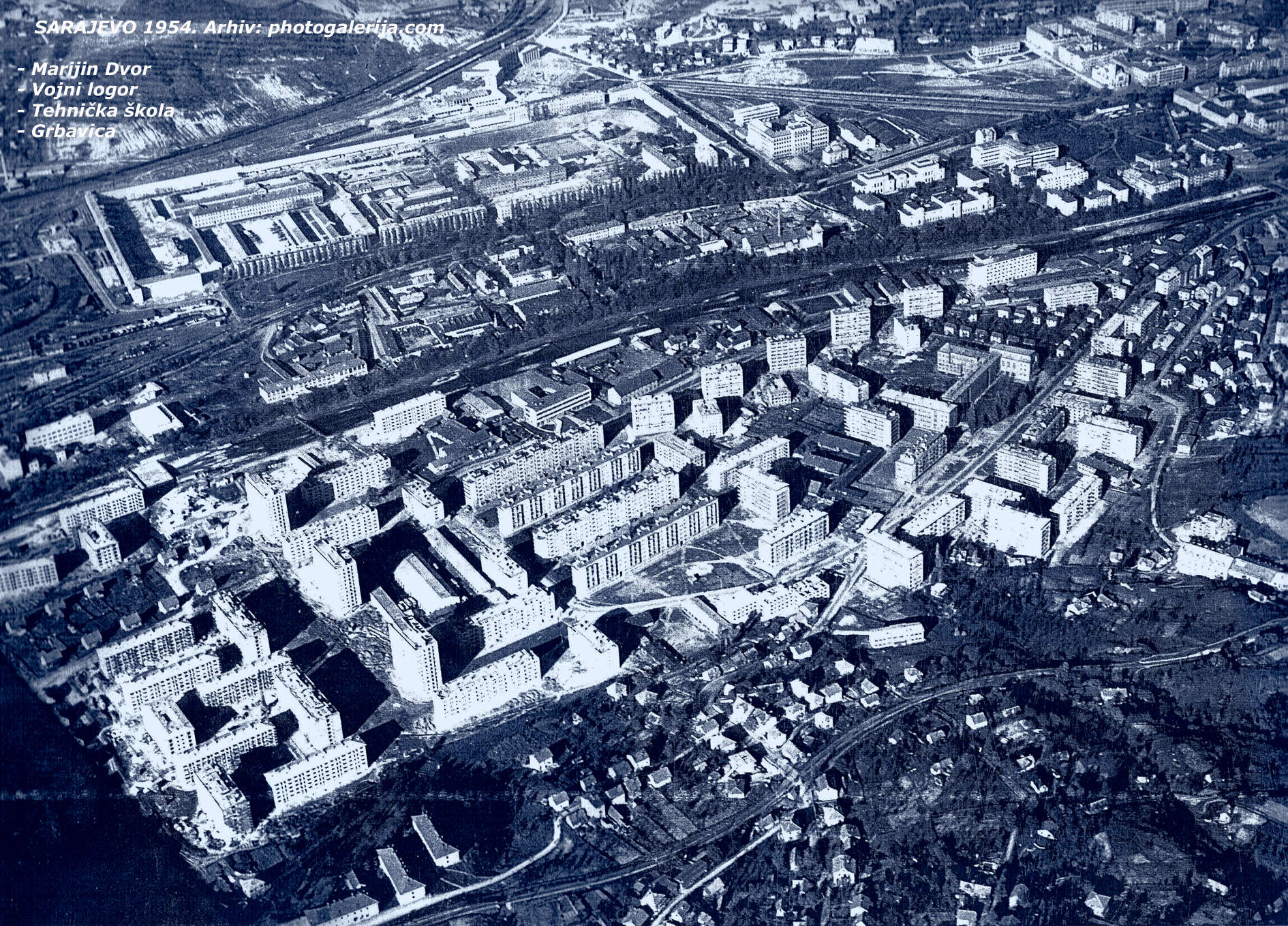
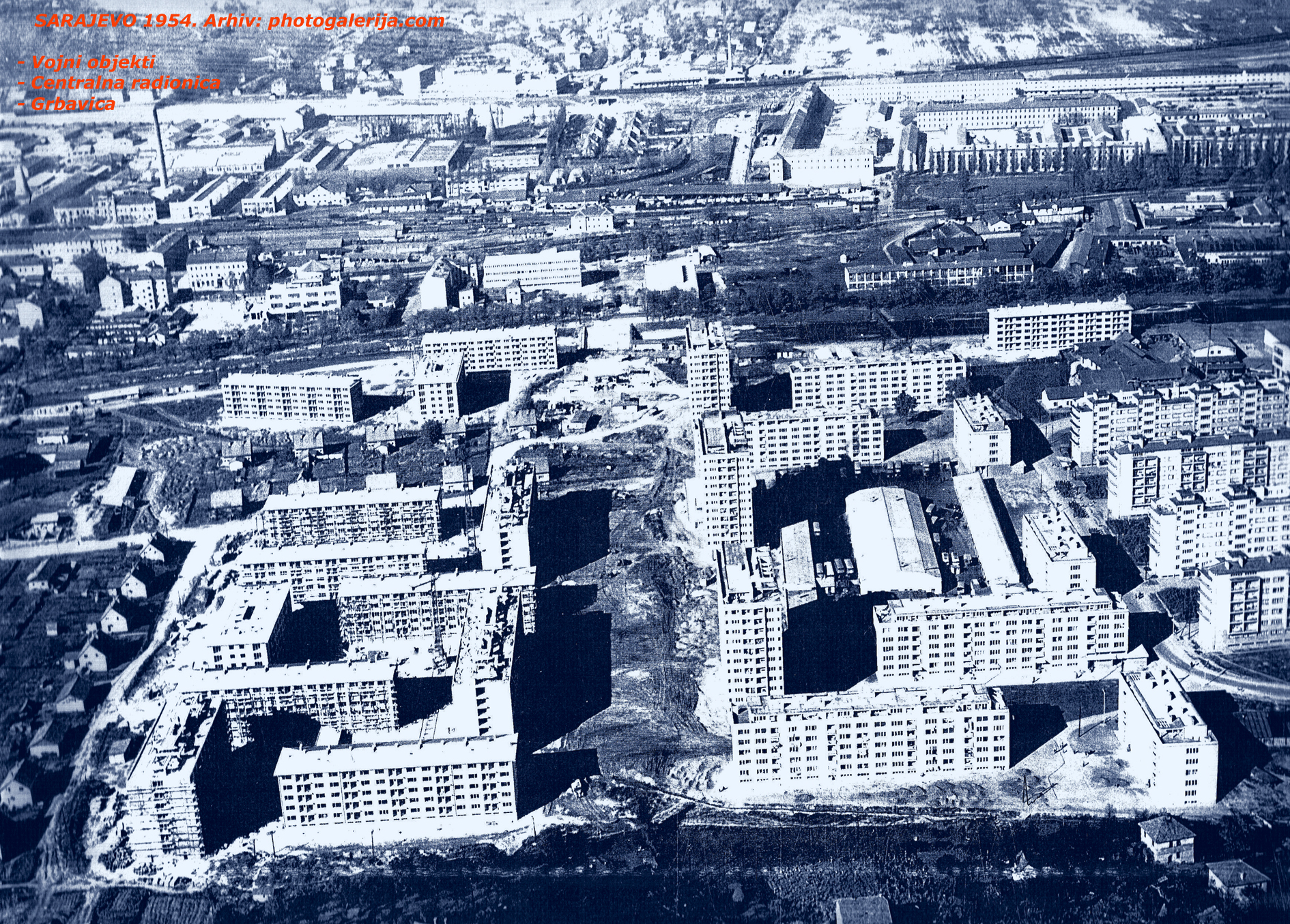
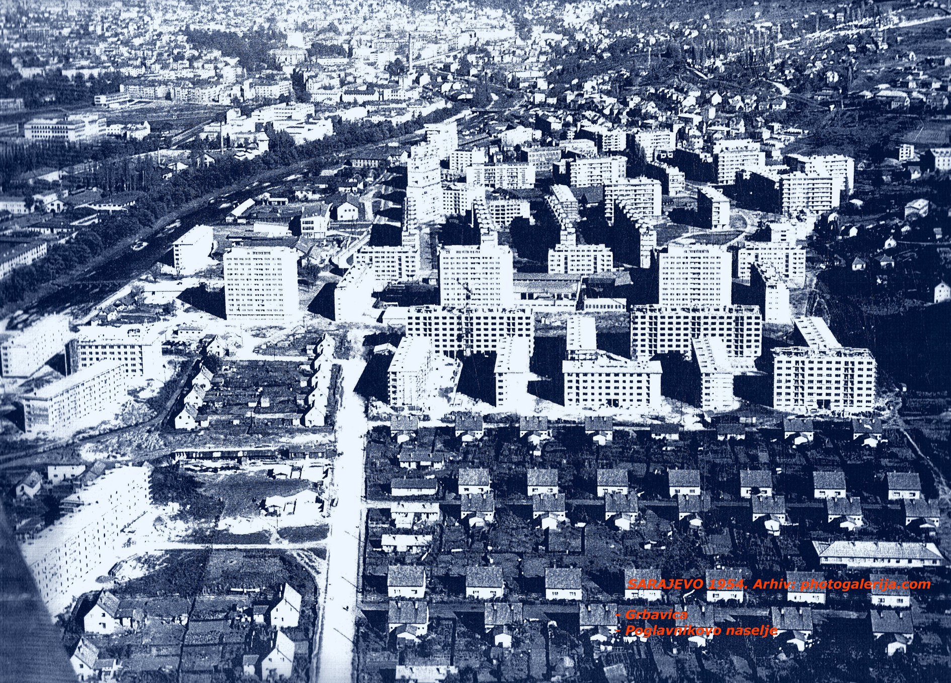
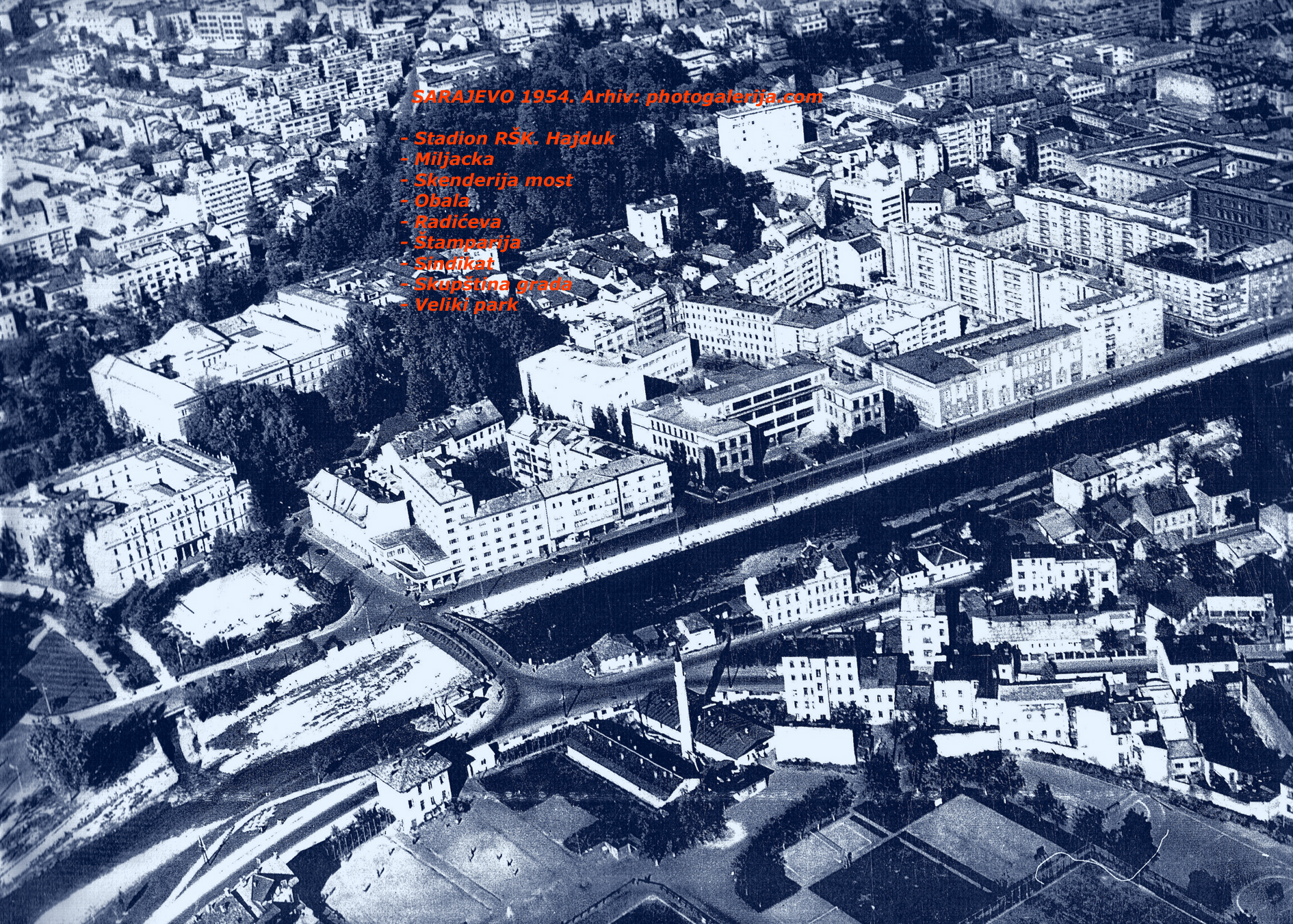
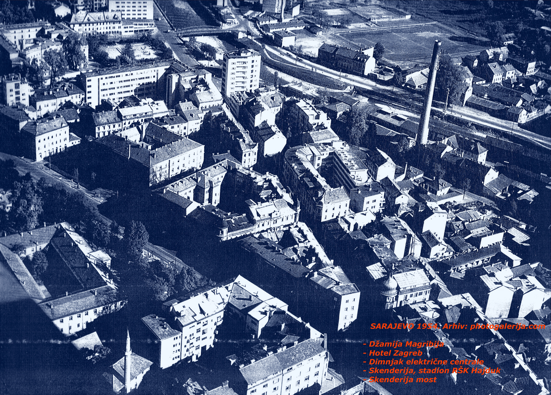
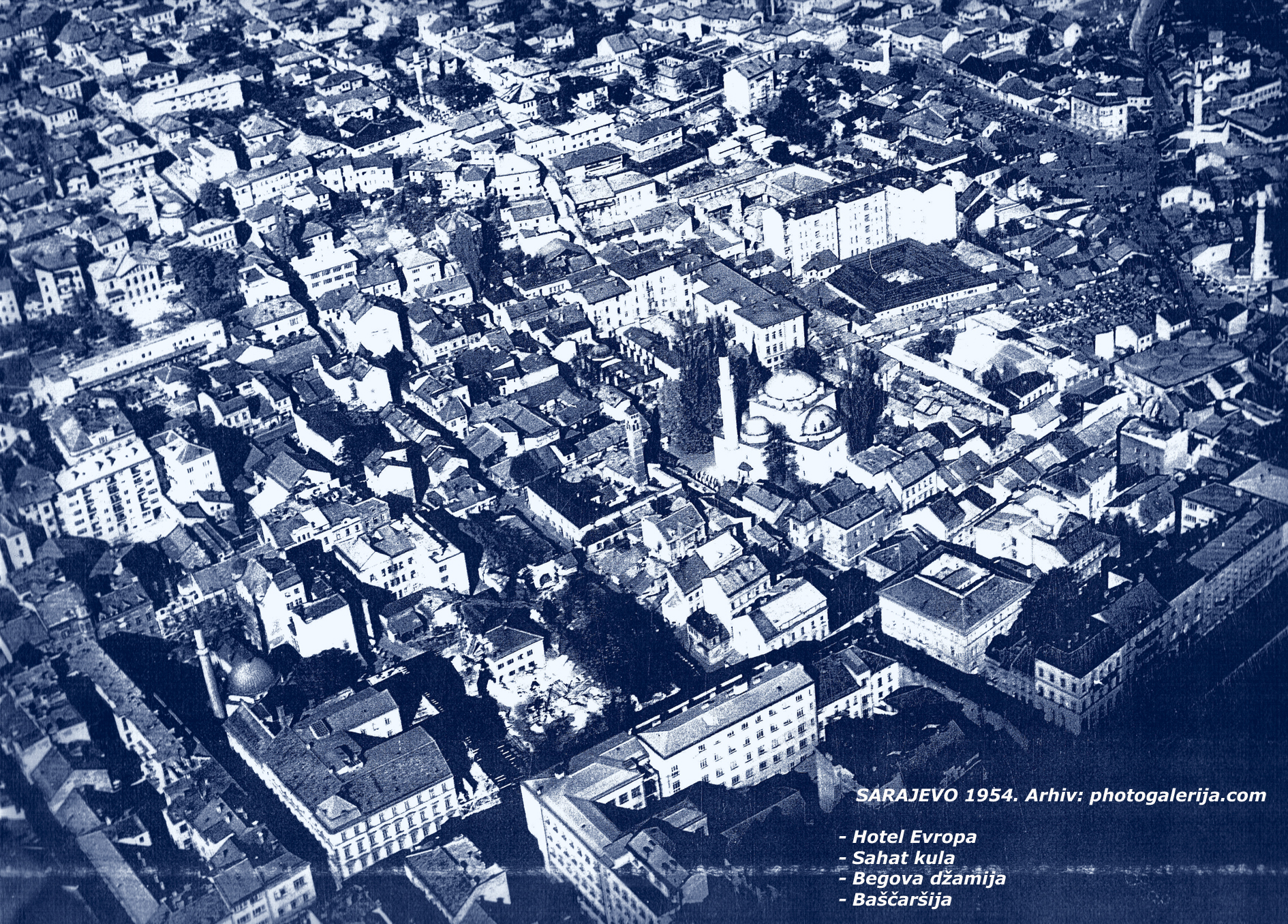
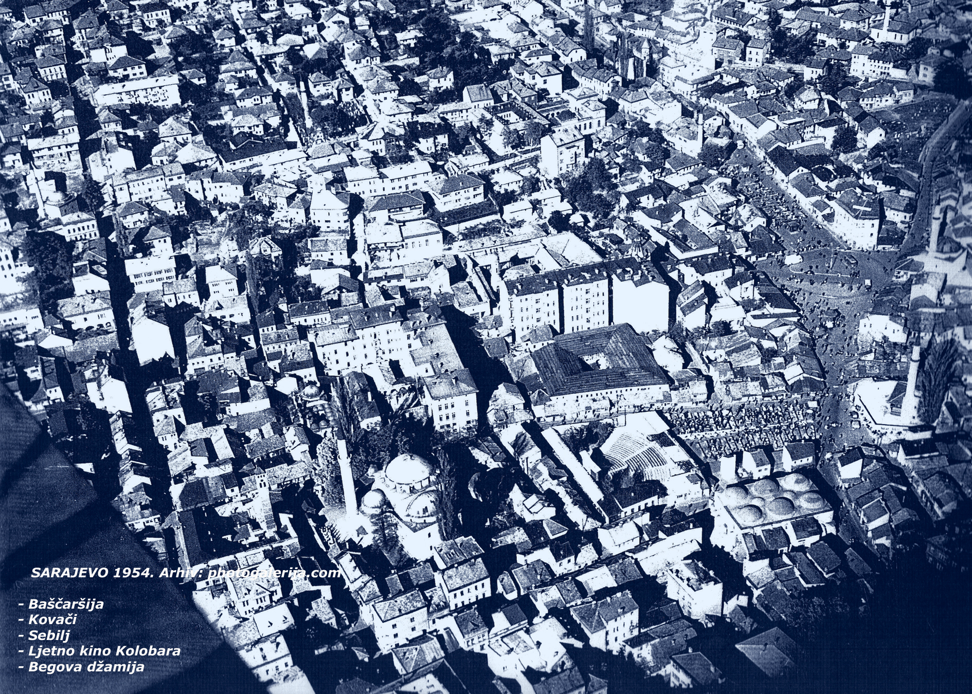
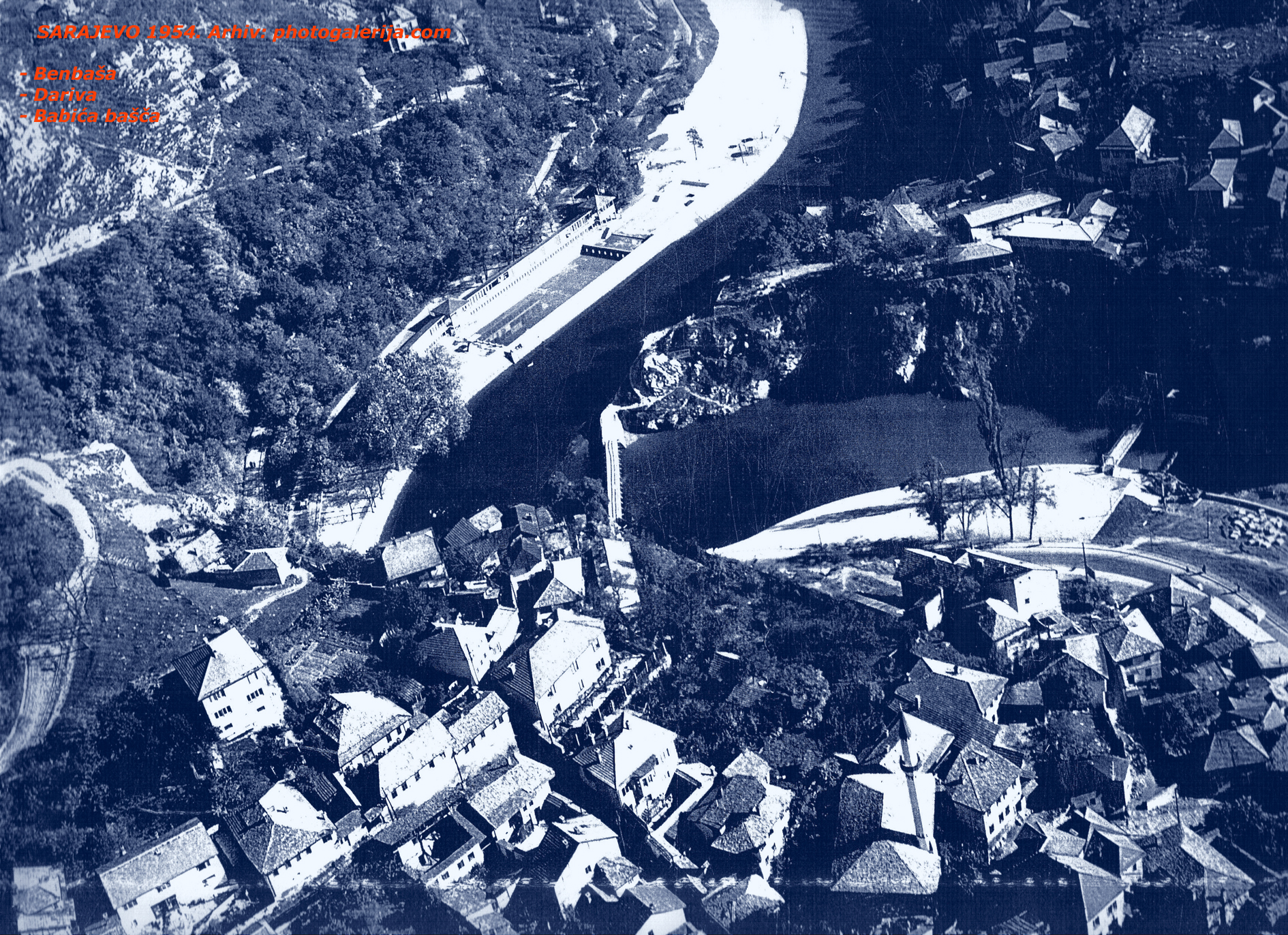
I am publishing rare aerial footage of the city of Sarajevo from 1954. It is very interesting to see the appearance and recognizable architecture of the city at that time, so that younger (and even older) generations can witness the changes in the planned development of the city over the past 60 years of construction.
As members of the older generation, we remember that with a single stroke of the pen, in other words, the official determines what and how will be built, and even today, with the help of these photographs, we can observe that on one parcel, buildings are emerging, while on another, nothing is happening.
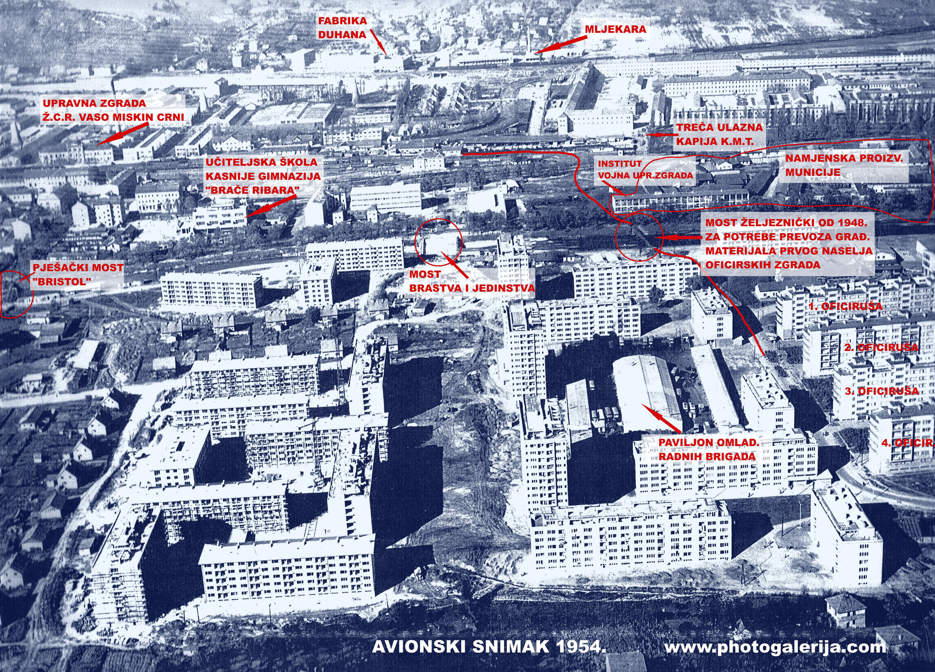
Likewise, with these published images, some will rejoice because they will see their house (building) in the past, which means it is legal and they won’t have to pay surveyors, architects, fees, and contributions related to scanning the state from 1968. For railway enthusiasts, it is possible to notice a “streak” along the narrow gauge tracks toward Bistrik and the narrow gauge track to the new railway station (opened for traffic in 1953), where it connected with the same track gauge as tram traffic. Additionally, the infrastructure of the Central Workshop (later Vaso Miskin Crni), the Sarajevo narrow gauge station, the military camp (“Marshal Tito” barracks), the large park at Marijin Dvor, the Skenderija plateau, and other locations where one can see the extent of the architectural transformations that have taken place.
I would like to point out that the displayed photographs are scans in A-3 format with descriptions taken from the original, and the quality is not so poor, considering they were taken with an analog camera and processed using what’s called cellulose aerosol technique, rather than a modern digital aerial photogrammetric camera (pushbroom camera), which is widely used today. Enjoy!